Transcript Podcast #10: AI in spatial development - from real-world laboratory to everyday application
With Annette Spellerberg, Professor of Urban and Regional Sociology at RPTU Kaiserslautern-Landau and Stefan Höffgen, Head of Digitalization Tegel Projekt GmbH
* AI generated translation
This is the podcast Raumdigital, the podcast on digitalization in sustainable urban and local development. [Dear listeners, welcome to the third part of the short mini-series on artificial intelligence in spatial planning. So far in the series, I've talked to Paul Meirath about the use of AI at the City of Zurich between innovation and responsibility, and in the last episode I spoke to Petra Ortado about AI in the American Planning Association's Trend Report for Planners. In other words, how to plan for the future with the future. If you haven't heard these episodes yet, be sure to listen to them. There are exciting insights from Zurich, supposedly the smartest city in the world, and insights into how the American Planning Association sees the technologies that are coming our way and how they will shape spatial development. And how it deals with space, what AI is doing to space and how it is changing spatial planning. I would like to welcome Annette Spellerberg and Stefan Höfgen. Annette Spellerberg is Professor of Urban and Regional Sociology at RPTU Kaiserslautern-Landau and Stefan Höfgen is Head of Digitalization at Tegel Projekt GmbH in Berlin. So we will have a scientific and a practical focus on the topic of AI. Annette, Stefan, welcome.
Good morning.
Thank you for the invitation.
You both deal with the topic of artificial intelligence in your work and you are both also members of a working group on artificial intelligence in spatial development at the Academy for Spatial Development in the ARL's management company. And Annette, you also chair this working group together with Klaus Beckmann. I myself am also a member of the working group and I am happy to link the other colleagues from the working group in the show notes. They come from planning, administration and research in the roof space, i.e. from Germany, Austria and Switzerland. But now let's get started. How is AI influencing space and how is it changing planning? Stefan, you are Head of Digitalization for the transformation of the airport cone. I assume you are using AI in the transformation. Can you outline how he uses it and maybe for those who don't know the transformation of the airport cone. A few more descriptions around what you actually do, what your mission is.
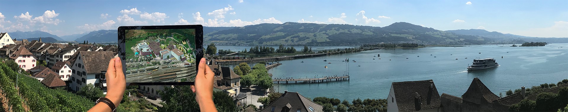
Exactly. We are Tegel Projekt GmbH and our mission as a municipal company is to transform the former Tegel Airport into a sustainable urban quarter that will also be smart and create space for 20,000 workers and up to 10,000 people who will live there in the future. And as a development company, we are responsible for this transformation. We will not mainly be building there ourselves, but we are preparing the entire path, so to speak, all the infrastructure and some of the buildings so that this neighborhood development can take place there. This means that we have a wide range of specialist planners with us, from building construction to infrastructure planning, open space planning and, of course, digitalization issues. And where we use AI. It's not the case that we are already using AI to the full extent, so to speak, but where we have done so, for example, is that we have aerial photographs from colleagues who carry out weekly flights here with threats, which are very high-resolution. And there is of course the issue that not everyone who is on the site wants to be seen. We also have refugee accommodation on the site and that's why we said we wanted to anonymize these images. In other words, if we ever release the pictures, they should be anonymized as far as possible. And that's why we've started working with the ITDZ, the IT service provider for the state of Berlin, to develop or train an AI, not to develop the AI, but to train this AI to clean up our aerial images of people and vehicles, so to speak, or at least to blur these objects. In this way, we want to guarantee data protection for people and make it easier to share these aerial images.
We use AI for this purpose.
Where else we also use AI is in the detection of plant species, for example. Here, too, an AI is trained to identify different plant species on the site in order to then carry out long-term monitoring of plant growth, including invasive species, but also simply to track the changes on the site in the long term, and then also to see how we develop the open space. We are doing this together with the state-owned company GrünBerlin. And perhaps as a third example, we're not directly involved as a team, but there are also companies that are driving on the site, testing autonomous vehicles, and of course they also use AI to make these decisions about the vehicles or to evaluate the data and run them via AI. These are a wide variety of use cases where we use AI.
So we're already actively using AI and if you look at the new quarter, the Schumacher Quarter is to be planned as a smart quarter. What are you planning to do or support with AI? Well, we
see the possibility, of course, in the mobility sector, that at least the companies we will be working with will have AI in use, so that the people movers, the autonomous shuttle buses that are to run here, that we can use AI to make the driving decisions or at least process the data in a meaningful way. Then perhaps there will also be AI, for example in the detection of bird calls and learning there, so to speak, because we have Animal Aided Design. This is, so to speak, a claim with which we try to use the growth and species richness. Then in the area of energy supply, AI will perhaps also be used there, because we are of course trying to optimize the energy process and learning systems and forecasts will be helpful, so to speak, in order to make better decisions and make this topic more efficient. Otherwise, however, we don't yet have a very clear roadmap as to where AI will be used. We will be writing an AI strategy this year and will try to define the main guidelines for us again: what types of AI do we want to use, what are AI systems that we might reject and where do we see the focus for the use of AI. And that will happen over the course of this year, particularly with the help of the expert group, the working group here from AAL.
And what do you expect from the use of AI? Why are you using this technology?
Put simply, it's to increase efficiency, so that we can make decisions faster, so that we can extract better results from the information we have or that we can process the large amounts of data that are available better and thus make data-based decisions. That's what we're hoping for from AI. I don't know, the experience that we also had in Hamburg, where I once worked, is that AI systems, assistance systems also help to not necessarily just replace routine work, but at least support it and that there are opportunities to really speed up processes, because the knowledge base on which you build is better prepared, perhaps also more extensive, thanks to AI.
And of course we want to make use of that.
In other words, you're already using AI extensively and you've specified how you want to use it further. How did you get to the point where you were able to deal with AI and set your organization up in such a way that you can provide test fields, autonomous driving and the like? How did you get started with this topic?
Firstly, this project that we have is the development of the former Tegel Airport, which is a place of innovation and a real laboratory. That is also our mission. We should also try out new things here that can be reused in other cities, municipalities and projects.
And so it is obvious that we also want to deal with new developments and technical innovations and use them accordingly. The other thing, of course, is that we don't do everything ourselves. I also said that many of the AI projects, especially autonomous driving, are not us as the Tegel project itself, but are either companies or research institutions that are setting up here on the site and testing things and have a test area explicitly designated here to investigate these things and gain experience.
This means, on the one hand, we as a company, as a driver of innovation, and on the other hand, the cooperation with many technical experts and institutions that support us or simply use the area and get space to try out these things here.
In other words, the best conditions for not only testing new technologies such as AI, but also being able to use them in real life.
Anette, now I'm looking at the regional and urban sociologist. Do all cities, do all projects have these good starting conditions?
Not really, or only to a limited extent, because the cities are organized. Tegel is actually a real laboratory and can start from scratch. This means that it is being built from scratch and the infrastructure is being redeveloped. The players are also coming together anew.
So that means that in this real-world laboratory you can actually find completely new forms of cooperation with business, science, companies and the city itself, completely new forms of interaction and organizational structures above all.
And in cities, the administrations are well-established, the structures are in place, the infrastructures are in place, the networks are in place and using AI there is of course much more difficult and often actually happens in real-world laboratories or in experiments, in smart city projects.
And the fact that AI is finding its way into regular operation in cities is happening very slowly.
For example, in the area of traffic control, traffic light control or in the area of sensors for green plants, automated irrigation systems, perhaps something like a chatbot for citizen services, data management systems, the first billing systems.
In other words, AI is slowly making inroads, perhaps even unconsciously to some extent. So when chat GPT is used in administration, it's not so much associated with artificial intelligence, but rather as a helpful tool that has just been further developed. And that it is perhaps an unconscious process in regular operations, except in experiments, real-world laboratories, in processes that are often supported by science.
And in your experience, is it more the large cities that set up real-world laboratories and then make the transition from real-world laboratory to administrative action, or are they also small and medium-sized cities?
Of course, the big ones have a head start. They have specialized personnel, such as digitalization departments. They also have greater financial leeway, so they have a better chance of getting started and have perhaps also developed strategies. Stefan has already mentioned AI strategies. However, medium-sized cities are also increasingly using AI. We conducted interviews in medium-sized cities and what is slowly gaining acceptance are traffic control measures, for example, or file processing or sensor technology or the vehicle that records road conditions, which then leads to automated processes to rectify defects.
In other words, AI is making inroads, perhaps most likely in the transport sector, i.e. mobility on demand, the Flexlines and whatever they are called, which are now being introduced, are also based on AI.
Optimized fleets, vehicles, optimized personnel deployment, optimized route guidance, continuous learning during operation, which I think works extremely well.
So AI is also at play there, without it perhaps being an AI project in the municipalities themselves.
To answer the question more precisely, that means more often in large cities, partly because cooperation between science, which is very often still involved, business and the city is easier to organize there than in medium-sized cities, which are also on the way.
And one reason for this, to address this as well, is the availability of data.
AI is based on large amounts of data, which are also better processed in large cities, on a larger scale and also pose a challenge for medium-sized cities due to the deployment of personnel.
No, that's clear. AI without data is inconceivable. And cities that have tackled the issue earlier have an advantage. There are also examples of medium-sized cities - I have Landsberg in mind, for example - that tackled the issue very early on, including with their own regular aerial surveys and constantly obtaining data themselves. But this is certainly a core issue, how to deal with data and ultimately make data from the various administrative silos accessible for AI, but also for other applications.
Stefan, if I have it right in my head, have you developed your own data platform for the, I don't know now, Tegel Projekt, GmbH, Schumacher Quartier or whatever, for this data exchange, which is also available as open source?
Exactly, that's how it is. Yes, we have set up this data platform precisely with the aim of organizing the data management for these, I would say, smart city applications.
This means that we receive data from a wide range of specialist domains, whether it's architecture BIM data in the best case or 2D plans. But we also get sensor data from a wide variety of sensor systems. We get data from other specialist institutions, including the administration. And of course, as Anette just said, we need to process this data in a meaningful way so that it can be used.
We need this data in order to run useful AI applications or, of course, other applications on it. And that's why we started developing this data platform three and a half years ago. Back then, we had the ambition to develop it as open source. And because it wasn't a system template, so to speak, we have developed it ourselves over the last few years with our service providers, with the support of or in cooperation with the city of Paderborn, and currently also in cooperation with the city of Bonn, and have now built up a very functional, comprehensive data infrastructure, which is running here in our company and which, and we think this is the great thing, is now also being used in various other cities, where two different projects have developed from it, the Data Space Community and the Civitas Core, which in turn are also being used in various other cities. And I believe that we have helped to develop a very good ecosystem, let's say, where we can now tackle this issue of data management at a municipal level.
And the goal is to integrate this different data into such a platform so that it can be standardized and exported according to a proper system.
That is also the challenge. Who is actually allowed to see this data? Who is allowed to receive it? How can it be used?
And we do this via this integration platform, which also has additional components such as dashboards, with which the data can be visualized, or by having a geoportal where the data can be visibly accessed by the public, but especially now also by internal colleagues, i.e. a protected space.
And where we then of course also look towards urban digital twins, which is always a lot of fun, but is also the right way, I would say, to develop good visualization and decision support systems from this data, which we and especially our colleagues can then work with to optimize their processes and make better decisions.
Annette, you nodded vigorously on the subject of assigning rights and who is allowed to see which data.
Yes, because, as I said, data is the central prerequisite for AI processes.
The data is subject to different rights in terms of data protection. So personal data, especially when you think about administration, social data, is very sensitive and you don't want to put it in a public data pool.
At the same time, X-Planning, for example, is standard, which means that the processes should be digitized with defined interfaces, preferably open source, so that the processes there are much simpler. This means that we have completely different requirements for the transfer of data in a municipality. We therefore need rules, i.e. very clear rules. Who has access to which data, who is allowed to use it and how, who is allowed to change it and how, who is allowed to handle it and who is allowed to pass it on.
So all issues from data protection to data availability and modification are very challenging. So we are running a large interdisciplinary project entitled “Aging Smart - Designing spaces intelligently”, in which this is happening, including what Stefan just said. We are working with seven municipalities. The data is available in very different qualities. The municipalities themselves have also formulated different rights and access rights, which they themselves say is or is not possible with the data. And it is extremely challenging to combine this different data, from population data to aerial images, tree registers and other data, in one tool for AI processes. For us, one example is the detection of plants in order to recognize dangerous situations in the summer when it is hot, when too much ozone is emitted by plants that are actually good in the shade when it is hot. This is also subject to AI processes. But then you have to combine population data with building data and plant sensor data, and the question is under what conditions which data can be merged and evaluated in combination. And this requires standards in every municipality, so that employees know what they are doing, how they can then use this data and if they receive some, let's say, decision support, in the sense of, let's say, routing in very hot weather and certain trees, plants, what would be a good routing. How to interpret such data. This means that employees in local authorities actually need to be trained on an ongoing basis, because AI is also developing incredibly quickly in a wide variety of areas. This means that we need further training in this area, above all in ethics, law, interpretation, access rights, so not so much technically, but in the use of AI in administration, in the organization and also new challenges for the organization of administration if AI is increasingly used, which is likely.
Right, Annette, can I interrupt you for a moment? xStandard may not mean that much to planners in Switzerland and Austria. Can you explain that very briefly?
Yes, it means that the documents required for a building application, for urban land-use planning, must be available in digital form, i.e. machine-readable, with certain interfaces so that they can be processed automatically, so that planning and construction can take place much faster in the municipalities. And this is actually also required by law, i.e. X-Planning must be adopted in the municipalities.
Perhaps I can briefly add that the exciting thing about X-planning is that you can make better deductions from the planning knowledge, so to speak.
So if I have development plans that are digitized and machine-readable, then if I also have a 3D model or knowledge about the development, I can find out what the GFZ is in certain areas, I can see whether this actually corresponds to the existing developments, where there may still be potential for redensification. And what is also very exciting, which Netta also mentioned, is when you can submit building applications. We are now working on a research project on digital BIM-based building applications together with the City of Hamburg, where precisely this digital data is being used to see whether it can be overlaid with BIM data so that semi-automated queries can be made to see whether the architectural design actually complies with building law and whether there are any contradictions. And this is precisely why this data is worth its weight in gold in the long term. My colleague Kai-Uwe Krause always talks about the digital twin of the planned city.
If I now take up the topic of language and mediation, if I have it right in my head, the ARL working group was precisely the starting point for saying that we need to bring together knowledge and transfer knowledge here. Annette, you were already involved as a leader before the working group. How did you initiate it? What were the reasons?
I myself worked on digitalization and spatial development and digitalization is of course a prerequisite. Artificial intelligence has been used in smart city projects and then the question is, of course, to what extent the spread of AI, which is somehow naturally also in the air, raises the question of what this means for spatial development, namely for changes in cities, organizations of for urban and rural disparities, for perhaps also social inequalities in the city, the use of workers, of cityscapes, i.e. if you think of platform economies. And it was clear that ARL, as an academy for spatial development, always works on the premise of combining science and practice. And I think that was also very successful in this working group, for example Stefan with Tegel experience, Martin Memmel from the German Research Center for Artificial Intelligence, who was also employed in the city of Kaiserslautern for digitalization AI processes. We have Jens Libbe from the DIFU, the German Institute of Urban Affairs, and Ms. Schweitzer from the BBSR, the Federal Institute for Urban Development. And so we have Mr. Othengrafen from the various disciplines, i.e. from the University of Dortmund, who has done a lot of work on governance and AI. So we found experts who had already worked on the topic, met several times, exchanged ideas, examined what we can do now, because we all work on a voluntary basis, are geographically distributed and of course had the ambition to be able to say something substantial on the topic of AI and spatial development. We limited ourselves to certain fields, i.e. governance issues, because governance is not so much direct spatial development, but governance steers spatial development, i.e. in the administrations. Plus questions such as mobility, to analyze more directly, to write down the state of knowledge and also to look at best practices, i.e. good examples, and to see what is already happening in reality and what it means.
And as a result, we then basically designed a scientific journal as a special issue, but we also produced a position paper that is intended for practitioners. Namely, to say that if you want to introduce AI in the municipalities now, then please think about what that means for the organization itself. So the focus was then on the municipalities themselves. So we again served science and practice in the output, not only working together, but also trying to take this into account in the process and in the output itself.
Stefan, you were part of the team that took a closer look at mobility. What can we expect in the context of AI and urban development from a mobility perspective?
Well, what has become clear is that AI is increasingly finding its way into various mobility systems. This is also happening gradually, sometimes not even consciously, whether it's in the evaluation of offers or analysis of offers, when it comes to ridepooling systems, when it comes to autonomous driving or semi-autonomous driving, of course, when it comes to looking at what the traffic situation is like and AI is used to process the data quickly.
That's what you notice. That's the kind of development that's happening. In the project, we also took a closer look at three examples where we looked at where AI is being used and how it is being used.
And what also emerges is that there is of course not one AI or one system that controls and directs everything, but that there are also very different actors, players, which brings us back to this governance issue, where it also becomes clear that there are very different interests.
In some cases, there are actors who steer and coordinate the whole thing. Then there are the players who sit in the technical engine room, so to speak, and build the AI systems. I think that's the first observation we can make. Now there was the consideration of the extent to which AI systems also intervene in traffic.
I would say that it's not yet the case that we have thousands of black boxes where we don't look in and AI is now somehow starting to take over everything, but there are perhaps many grey boxes where we don't know exactly how it works, but different players control different systems and I wouldn't assume that AI will somehow take over the mobility system too quickly, perhaps if you start from this fear. But the fact is that AI is being used, AI is helping, AI can improve decisions somewhat, can speed up decisions and it is also creating new services that could simply not be operated efficiently before without this large, fast data evaluation. That's what we can say.
May I briefly interject, because I think that this is also a great opportunity for the urban-rural connection and also for the transport situation in rural areas.
So if you say that we actually have a fleet of small buses that can be ordered on demand, i.e. according to demand, when the situation arises that you want to take a bus, you can actually order one and then order a small bus at certain stops, I would say very close to home, and it will take you where you want to go.
In other words, Mobility on Demand, which is already running in some municipalities and I think is extremely successful, where you say you want to be in the city village at half past ten and you order a so-called Flexline and it takes you there at half past ten.
Without a regular service, without a big bus, but still using local public transport and not as a cab, but integrated into the prices of local public transport, usable with the Deutschland-Ticket, for example, and so that you actually have an individualized transport option in rural areas or at least in rural areas close to the city.
So this is the first starting signal. But I believe that this will significantly change mobility and create a mix between public and private transport. And I think that's a really great development and you need AI for that.
Thank you for this addition. But we will definitely have to talk about the spatial impact of AI later. But Annette, perhaps let's talk about governance. You were part of the team of authors and you have already said that governance is not directly spatially effective, but that the organization is created under the spatial effects. What are the topics that you address in your paper and have previously investigated?
Well, it's about administrative processes, which are very segmented in Germany, i.e. divided into different departments and divisions, and that makes it very difficult to use AI when it comes to organizing things across the board.
And in the administrative structures, in order to use AI, it is necessary to think about how we can do this and how we can guarantee it. In other words, we need a management structure that says, okay, I really want to make data-based decisions. I want to optimize the processes. Stefan has already said that. We want to significantly optimize the use of manpower, which is necessary because the baby boomers are retiring. This means that we have an incredible gap in the public administration workforce. By 2030, half of the baby boomers will have retired. That means we have a huge demand for labor. We have many routine tasks that can be automated. So from the mailroom to invoicing, to merging applications, i.e. also processing applications, to things like assessment processes when it comes to construction issues. In other words, actually structuring the vast amount of data, making it analyzable, making it easier to handle, preparing it and thus actually relieving the staff that is still available so that they can then actually make the decision. So, whether it's about housing benefit or a building application, it's about actually getting the available information into digital processes in the first place. And what is needed for this, i.e. a real leadership that says, yes indeed, we have to digitize the administration, otherwise it will no longer work. We need data governance, as we have just said. We need the question of staff deployment. We also need questions of restructuring, perhaps we need to say that we need digital departments with two or three people and perhaps we need to pool positions that also receive a proper pay scale, because otherwise they will not be available in the administrations and the administrations will be disconnected from general social events. Nobody wants that, because then there is a risk that some companies will come along and say, we have the best solution for you, then they will be bought in and then you can no longer shape things.
You might have lock-in situations and have to buy your own data, etc. In other words, it will be necessary for administrations to organize themselves for the future despite the constant workload they have. And this includes data organization, management, personnel deployment, know-how.
So how do they get the specialist staff, how do they get the know-how? How do I create a sustainable strategy, because the budgets are tied to years or double budgets. However, the use of AI requires financial resources that must be secured in the long term.
You need servers, for example. That means you have to buy things. You have to ask yourself which ones and how. Where are they located? Servers are now controlled by AI, water-cooled, i.e. liquid-cooled. Where are they located? What does that mean in terms of sustainability?
In other words, there are a lot of follow-up processes involved and the administrations have to get involved in this topic and it is not enough to see it as a technical issue. It is not enough, it is a socio-technical, organizational-sociological, coupled task, a long-term task. And I believe that many local authorities are on the cusp or are using AI selectively, lighthouse is all good, but this organizational hurdle still needs to be overcome.
So I can confirm that. I am part of the Development Stages team, where we have looked at precisely these hurdles or this step from an AI application, from individual AI applications to digitized spatial development, and have developed a five-stage model for precisely this time, saying that it's not just about bringing the technology up to date, not just about organizing the data and working across silos, organizing the data and making it usable across silos and not just about taking people with you, from reducing fears to schools and setting yourself up organizationally in such a way that you have the appropriate regulations, but also the ability to decide within the organization what you want in terms of data, technology and further training so that the organization is fit. And we said in our article that these development stages are necessary. It's not about getting everyone to level 5, but there is a big difference between the levels, that technically you are at the highest level, but when it comes to taking people along and organizations and frameworks are only at a basic level, that can't work. And the results of this working group, as you have already mentioned, will be summarized in a special publication by the planning sub-publication DISP.
And we can also do a bit of advertising right now. There will be a vernissage for the publication on June 5 in Berlin. Stefan, it's at your place in Tegel and can you both say something about the program, if the listeners, perhaps those from near Berlin, say, yes, June 5th is just right. What kind of event is it?
Yes, it's an afternoon event that lasts three hours and we've invited colleagues from the field who use AI. It's a representative of a smart city, namely Gelsenkirchen, which has various AI applications. The focus will be on mobility. We have invited two colleagues who have founded companies that develop AI and use it in municipalities in different places, so we have basically always planned to form pairs for the event, namely to look at governance, development stages and mobility. In each case, one external presentation, one presentation from us, in order to then actually get into the discussion, scientific practice, what is actually happening on the ground and how the processes can be scientifically classified.
What does this also mean in social terms? So that we can hopefully make a transfer here too. In other words, to continue to influence society with our findings from the working group.
And we at Tegel as an event location naturally hope to be able to transfer this back to us. On the one hand, through the networks that exist, but also by putting the knowledge back into practice here. One thing, as I said, was the AI strategy that we have adopted in order to be prepared to take these steps, but then also to take up this topic further in practical projects, technically supported, in real application examples, use cases, to test it here and then to test it further with our colleagues, we already have a broad network, and then perhaps also to bring it into real operation.
Because I think that's always a big challenge that you have from practice, is to have these initial projects, applications that are really operational on a test basis, so that they really help here, run continuously and then really improve the processes that we have in-house. And that's a long way off, so we hope that this event will really help to get things moving again.
And there will also be similar events in Vienna and Zurich before the summer break to stimulate the transfer in Austria and Switzerland.
So, now we've had enough of the advertising block.
I think the interesting thing is, once again, that this is an interdisciplinary working group, a transdisciplinary one, because we are combining science and practice, and an international one too. So it's this bringing together of people and the different cultures that exist. In Austria, for example Vienna, we have an AI application that is very participative and very advanced, whereas in Switzerland the framework conditions are perhaps different. So you can see once again how many components come together when it comes to the use of AI, namely the cultural background, which also has to be taken into account. >>
And this is a topic that we discuss from various perspectives in the working group, but also in other areas of science and practice. One question that we keep asking ourselves is “How spatially effective is AI?” And if you look at the literature, the answer is very poor. In the working group, we have repeatedly discussed three perspectives: in terms of spatial impact, of course, what has already been mentioned is the direct infrastructure, i.e. where are the servers located, how is the energy supply for the servers, how is the cooling, are they quasi stand-alone or are they embedded in settlement structures?
Then there is the indirect aspect, which was also part of the discussion: how do other players, platforms, the economy, for example, act?
How is space organized, also with the help of artificial intelligence? And the third thing that we have already touched on is craftsmanship.
How do we do planning? How do we get data faster? How do we obtain data that can be better exchanged in order to achieve planning results that are closer to people's needs? Would you support these three perspectives from your point of view, from a scientific or practical point of view, or do you have examples to add?
Well, I think the division is fine for now. I don't think you can really assess the consequences in this way. So if you think about the platform economy. Everyone always uses platforms.
The whole of tourism is now platform-based. But many people aren't even aware of that. So from booking to Tripadvisor, to hotel bookings, to sorting, everything is organized digitally plus AI. In other words, the tourism industry has been completely restructured according to AI principles. So which restaurant we go to is supported by TripAdvisor. When we think of delivery services in the city, it changes the cityscape. We now have these so-called dark stores, which have shop windows hanging down because the delivery services have their storage rooms there so that they can quickly distribute their goods around the city on cargo bikes.
They used to be shop windows, but now they are gone. That doesn't make the cityscape any prettier. We have a lot more cargo bikes, distribution stations etc. in the cityscape. We have a different use of labor, which means fewer employees subject to social security contributions in the city. We have also created a lot more dependencies through evaluation systems. In other words, people's social security is subject to completely different conditions, which of course also has a spatial impact when you ask yourself where people live, what can they afford? The whole question, then you're back to housing agencies, Airbnb, etc., for example. In other words, the organization of urban life is already being significantly shaped by AI without us really being aware of it. And this is changing social structures, spatial time patterns, i.e. when does what actually happen, where is what organized and in what contexts. In other words, very fundamental questions of coexistence are affected, without the spatial impact of the AI of this one process being broken down. But through the combination of very, very many areas of application, the use of space, the production of space, the appearance, the aesthetics, etc. change. In other words, social processes are fundamentally influenced by AI.
We have not yet addressed participation and involvement, but only everyday life, which is changing significantly. So that plays a very big role and then the question of craftsmanship naturally also plays a big role. Because I'm employed here at the RPTU and the question is how we train the spatial planners who will soon be working in local authorities and offices. Of course, they have to be able to do everything georeferenced today. That means they have to be able to use the big computer programs. They are already learning how to use AI. They have to organize themselves differently, even from the offices. In other words, local collaboration in an office is becoming increasingly superfluous thanks to the networking of people worldwide, the exchange of data via standardized procedures, the exchange of data, the international nature of design support, in other words, what Stefan has just mentioned, i.e. if you know certain framework conditions, the legal background, all the technical requirements, assistance systems can produce the first drafts. Then the planners and architects can optimize and design. But that means that the entire preliminary work is perhaps already done. In other words, the profession of spatial planner will also change significantly with the use of AI, which in turn requires an awareness of data, data bias, insufficient data and the potential risks associated with the use of AI. In other words, when it comes to training, we need to raise awareness of the basic principles involved in the use of AI. And what it means when you have bias data, i.e. data that is not representative, excludes certain population groups, has certain consequences for certain population groups and is perhaps also outdated, not collected in full, etc. So the quality of this data needs to be improved. In other words, the quality of this data is also very important for the training of spatial planners. So before we bring a lot of things together very quickly and get all excited about what great things we can now do, we must always be aware that we first have to check on what basis we are then planning.
So I can confirm that. These are exactly the considerations that we also make here in Rapperswil and data literacy, for example, is one of the topics that we are now discussing with our students. The spatial plan has always dealt with data, but it was usually data from state or federal statistical offices, so it was quality-checked. This part has been outsourced, but if we now have more data, more user and usage-related data, which is good for planning, but then we have to have exactly this competence ourselves and understand what is behind it and ultimately we are building on sand or building on rock and we have to understand that before we go into these processes.
And I'm absolutely with you on that. Ultimately, we also have to convey this to the students.
I also believe, perhaps as a supplement, but I also think that a truly reflective approach is essential.
I don't always know whether the planning activities will change so drastically. But what is really changing massively are the tools that planners will work with. So what do they use, what tools do they work with and where do planners suddenly start in certain processes.
Sometimes you may already have drafts and then have to modify these drafts that have been proposed by a machine, moderate them and bring in the various stakeholders.
The design may change, but so does the handling of how you work with these tools. That's why I think it's really essential to know why these technical systems work and to have a reflective approach to them, including what Annette said about bias data.
And what are these decision-making systems that run in the background? So who actually decides what? Is it people now? Is it certain institutions or is it perhaps actually technical systems that have pre-decided or prefabricated things? And I think that's something you have to deal with. And it's helpful to have this knowledge when you're looking to the future as a planner.
I'm a sociologist, but as far as I know, it's more challenging if you have all the plans available digitally and at various levels, i.e. very detailed, perhaps even geared towards individual properties with all the information, i.e. building age, stored figures, then at the next level the population data is included, with pollution from, let's say, air, noise, residential areas, classes, etc., and so on.
In other words, a great deal of detailed data needs to be available at the various levels of a municipality and you can always zoom in.
And I think that's a new requirement, also for planning, namely to know, aha, now I also have to provide the information, I have to store it in a well-prepared form, because people are looking at exactly what's happening in this specific place.
So at least that's what I've taken away with me, which is new. That it doesn't just go as far as regional plans or large-scale spatial development models, but is really looked at down to the smallest units.
Yes, exactly, this lack of scale that I have at the click of a mouse, but don't understand at all at what level of detail the data was collected, at what level what is decided, because I can simply change these scales with the click of a mouse.
And we all still drew plans by hand. And if they weren't good, we used a razor blade. And we were very aware of the scale of the plans. And young people are no longer aware of that. You can't blame them for drawing plans by hand again.
But it's also a different way of communicating spatial concepts that we have to teach young people, even though we are socialized completely differently.
That's nothing new with AI, we already had that with 3D. For us, everything 3D was technically on top. Now it goes without saying that even the building survey is in 3D, because reality is in 3D.
But we have to deal with it differently, to create an understanding of space and also a responsibility towards political responsibility in the end.
So, we have now laid out a broad bouquet of how AI affects space, how AI affects the way we do planning and also referred to events that, if you want to read more or get into discussions with those who have dealt with it, you can do so.
Perhaps a short final round at the end. AI and spatial planning, how do you see the future? What are the biggest issues we have to face and what are perhaps your greatest hopes or fears?
Well, I think the organizations in the administrations, that's the biggest challenge and that means the use in spatial planning itself. and really ask the regulation, so also when it comes to spatial effectiveness, to have good ethical framework conditions that actually correspond to the guidelines again, namely sustainable, oriented towards the common good, to the principles of good planning for healthy, sustainable cities plus rural areas, which is a field that is pretty much hidden, and thus not to leave the field to the big companies?
For my part, I am quite hopeful about the future. I can already imagine that AI will bring positive developments for planning, for cities and for local authorities. What I see as a challenge is that we don't focus on AI or focus too much on AI. I believe that, as has already been said, there is a lot of basic groundwork that needs to be done in advance. Whether it's data preparation, data management or even reflective knowledge of the processes behind it, which perhaps also follow the political views of society.
And that's where you have to focus your attention and put energy into and not just look at the high-end AI systems and the great applications you can make with them. I believe that if we can achieve this in a balanced way and if we use AI where it really has a benefit, i.e. if we reflect on it critically, then it can help us all. I hope that we can achieve this through such working groups and lots of discussion, so that awareness is raised.
Yes, Annette, Stefan, thank you very much for talking to us.
You're very welcome. Thank you very much. And finally, perhaps a word of thanks to the other members of the working group, who I would like to mention now. Klaus Beckmann, KJB Kommunalforschung; Emilia Bruck, TU Vienna; Martina Hülz, ARL; Florian Koch, Hochschule für Technik und Wirtschaft, Berlin; Jens Libbe, Deutsches Institut für Urbanistik - difu; Martin Memmel, Deutsches Forschungszentrum für Künstliche Intelligenz; Frank Othengrafen, TU Dortmund; Annette Spellerberg, RPTU Kaiserslautern-Landau; Eva Schweitzer, Bundesinstitut für Bau-, Stadt- und Raumforschung - bbsr and last but not least Eva Reinecke from the City of Aalen.
Thank you very much for listening. You can find more information in the show notes. You can also check out the blog raumdigital.ost.ch. If you know of any interesting projects or exciting guests, please write to me, I look forward to your input.